

Stormy warnings
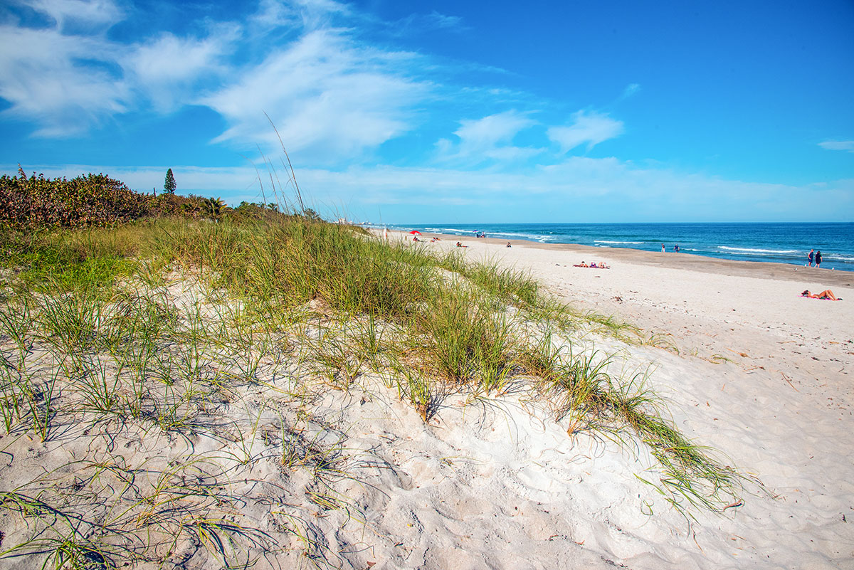
Sea oats and seagrapes planted in Melbourne Beach dunes helped save the town from flooding during Hurricane Nicole. FRED MAYS
Brevard communities developing action plans to combat dire flood predictions
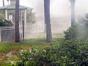
Hurricane Ian batters the Banana River at Cape Canaveral. CHRISTI DAVIS
When hurricanes strike, as they did twice last year, wary eyes turn to storm surges and street flooding from torrential rains. Unlike parts of Volusia and Flagler counties, the Space Coast escaped major damage from hurricanes Nicole and Ian. But the storms were another wake-up call for Brevard beachside communities.
About four years ago, at the direction of regional planners and the Florida Department of Environmental Protection, coastal municipalities undertook studies to examine the long-term consequences of storm flooding and sea level rise. Even the more optimistic projections are unsettling.
Many view sea-level rise as the threat from the Atlantic Ocean. However, flood maps and experts agree it is the related rising waters in the Banana River and Indian River Lagoon that pose the most threat.
By 2100, large back-island areas along the Space Coast are projected to be permanently flooded and uninhabitable. Most Floridians alive today won’t be around for that, but children and grandchildren will have to face the insidious effects of the climate change reality.
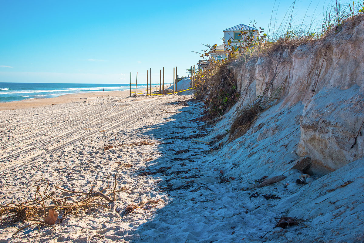
Erosion washed away the dunes at Satellite Beach during Hurricane Nicole. FRED MAYS
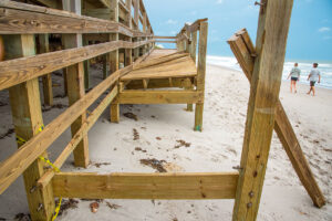
Storm surge destroyed a beach access crossover at Indian Harbour Beach. FRED MAYS
DIFFERENCE IN PROJECTIONS
Flood projections on the Space Coast come from the Army Corps of Engineers and the National Oceanic and Atmospheric Administration. The two forecasts vary significantly. The Corps estimates sea-level rise at 5.15 feet by 2100. NOAA projects it at 8.48 feet. The difference is plainly evident when you look at flood projections on street maps in communities like Cape Canaveral and Indialantic. Many back-island neighborhoods will be permanently lost to the rising waters. And it could happen before 2100. According to flood maps, some areas will be impacted as soon as 2050. Some flood even today during heavy rain.
Along the oceanfront, dunes will continue to provide some protection except from major hurricane storm surges. Keep in mind, both Ian and Nicole were only Category 1 hurricanes by the time they hit this area, and yet caused significant dune destruction. The effects of a major storm could be more consequential.
Randall Parkinson of Melbourne, a coastal geologist, conducts studies for coastal communities that project sea level rise. “It’s not a question of if we get hit by a major storm, it’s when,” he said.
Brevard County participated in a planning survey in 2018-2019 that measured flooding impact of storms and sea level rise. Brenda Defore-Suprenant of the East Central Florida Regional Planning Council directed the study for beachside communities. “The study was to measure the ability and capacity for communities to bounce forward” after storm events. She said the study identified action items for communities to take.
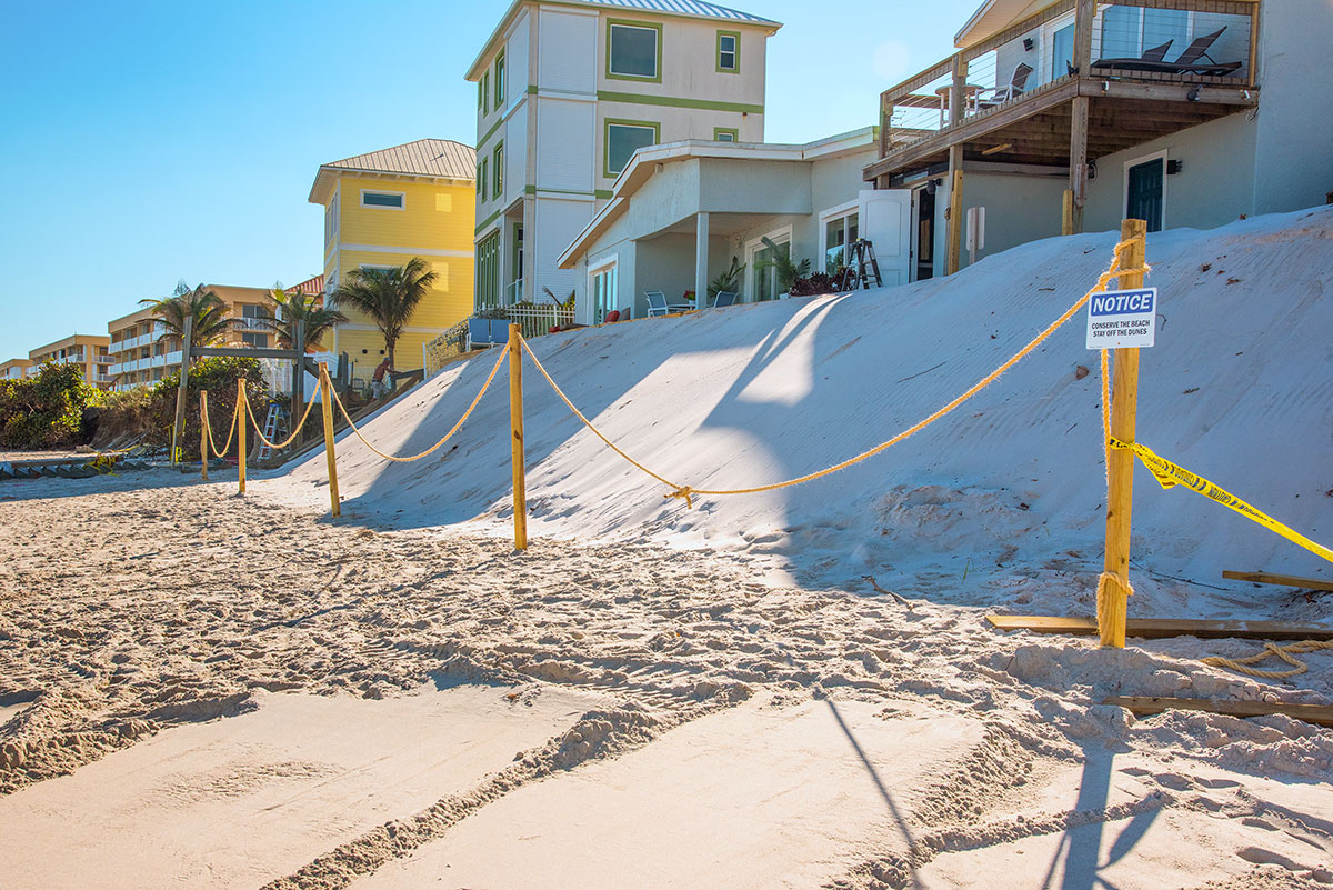
Sand was dumped on the beach to form a private dune in front of a Satellite Beach home following dune erosion from Hurricane Nicole. FRED MAYS
MULTITUDE OF PLANS
The City of Cape Canaveral, for example, has developed eight action plans, all designed to mitigate flooding and impacts of sea-level rise. The plans contain many green measures to combat climate change on a local level.
These measures include planning for low-impact development; curbing the types of growth in flood prone areas; mangrove planting along the Banana River; improving stormwater runoff systems and even encouraging residents to use rain barrels to reduce runoff.
Zachary Eichholz, the city’s sustainability manager, says such steps obviously won’t impact global climate issues, but hopefully “will buy ourselves decades of time.”
Cape Canaveral resident Christie Davis says there is regular flooding in her back-island neighborhood. She rode out Hurricane Ian in her condo, but called it “one of the scariest things I have ever witnessed.” Davis, who evacuated to Orlando ahead of Hurricane Nicole, called the stormwater drainage system antiquated. Eichholz said improvements are underway and last year’s storms “galvanized those efforts.”
At Satellite Beach, there was significant beach erosion from Hurricane Nicole. Many beach crossovers and stairways were destroyed but there was no major structural damage. Parkinson and his team did a study for the city in 2011. Because land-use and zoning changes take years to implement due to a complex legal tangle of state and local regulations, he says it’s only now that many of his recommendations are being implemented.
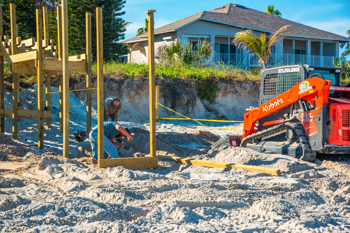
Workers are building a new beach access crossover for a private homeowner in Satellite Beach. The amount of beach erosion is evident in the background. FRED MAYS
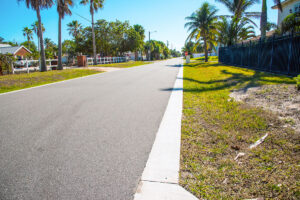
Melbourne Beach has been installing ribbon curbing along town streets. It is expected to promote stormwater runoff and a lessening of flooding on the streets. FRED MAYS
CLIMATE CHANGE EFFECTS
Parkinson’s work shows what he calls a tipping point by the year 2050 when beachside communities like Satellite Beach face irreparable effects of climate change.
The Parkinson study projects sea level rise at Satellite Beach of 2.5 feet by 2050, and 5 feet by 2100, at which point he estimates as much as 20% of back-island land may be submerged.
Indialantic escaped structural damage from Ian and Nicole, but its officials acknowledge neighborhoods along the Indian River Lagoon face long-term flooding dangers.
“Indialantic knows the lowest area along the lagoon is the area of Miami Avenue and South Riverside as it is the lowest area within the incorporated area as seen by the flood map,” Town Manager Mike Casey said. “The town is in the process of updating our stormwater system and creating new detention areas to help with flooding issues.”
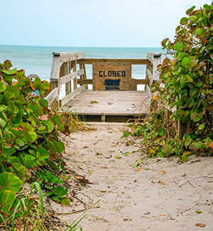
This makeshift sign notifies the public that the beach access is closed at a south Brevard County park following damage from Hurricane Nicole. FRED MAYS
DEPENDS ON DUNES
The town of Melbourne Beach didn’t have any flooding during the hurricanes. Vice Mayor Joyce Barton says there was dune erosion, but the town regularly plants sea oats and seagrapes in the dunes to minimize erosion during storms. “We take care of our dunes, they protect us,” Barton said. The town is installing what Barton called ribbon curbing on some city streets that promotes runoff, and doesn’t block water drainage like typical raised curbs do.
Major beach erosion occurred at Canaveral National Seashore.
“Much of the road is covered in sand, and some dunes are now on the west side of the road at Playalinda,” according to park spokesperson Laura Henning. The seashore was closed for several months after Hurricane Nicole, and limited access to some Playalinda parking lots only started in January.
The park service generally has a policy of letting nature take its course. Henning says 10-12 miles of dunes were lost. “If they were meant to move, they’re going to move.” She says park management is just in the beginning stages of their planning for the future use of the seashore.
Brevard County parks along the south beaches were heavily eroded by the hurricanes. All were closed for several months. Some are still closed as the county brings in truck loads of sand to rebuild the dunes. Before heading to a South Brevard beach, it is best to call the county parks department, at 321.633.2046, to see which beaches are open.
KSC SEEDING WORKED
The Kennedy Space Center has long recognized the importance of its dunes to prevent flooding during hurricanes. “Our shoreline fared quite well … we did not have any dune breaches in either storm” in 2022, according to Donald Dankert, KSC’s shoreline manager, in charge of environmental planning. Dankert said the space center’s dunes suffered some erosion, but the practice of seeding the dunes with native coastal plants did their job. “Our base standing is for 2080. Until then we don’t see any direct or major threat” to the Space Center, from sea-level rise.
Beachside Brevard continues to grow, and more people are moving into areas that face an inevitable threat from sea-level rise, especially back-island neighborhoods that front on the Banana River and Indian River Lagoon. Parkinson projects that at some point insurance companies and mortgage lenders might impose restrictions on development in those areas.
So what can be done?
Eichholz of Cape Canaveral acknowledges that if NOAA’s 8-foot sea level rise projection is accurate it would submerge large areas of the city, but he’s optimistic about solutions for the future. “Humans are a very stubborn bunch.”
Even Parkinson believes there is hope. “In my 20-plus years of experience, in the early years it didn’t seem that anybody was listening, but the last three to five years are encouraging.”

Fred Mays
Fred Mays is a freelance writer and photographer who resides in Satellite Beach. He is a retired television journalist, and active on media issues with the Brevard Indian River Lagoon Coalition. His blog is www.floridaunplugged.net.